
Determination of the background quality
Elaboration of bathymetries and detail cartographies
Definition of thickness and type of sediment
Characterization of oceanographic conditions in subtidal areas
Monitoring and quality control in dredging operations
Stability assessment of maritime works and movement of blocks
Location and positioning of submerged structures and objects
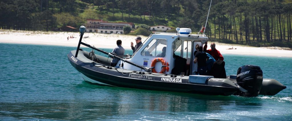
INNDAGA is equipped with scientific instrumentation with the highest performance in the market:
- Trimble SPS DGPS positioning system
- Side Scan Sonar Klein 3900
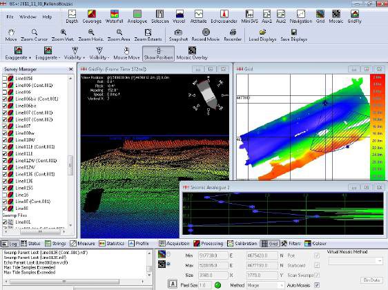
- Multibeam Kongsberg GS +
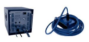
Inomar Compact 2000 Echosounder
UWITEC tester (60 and 120 cm tubes)
- Van Veen Dredger (Capacity 500 cm2)
- Niskin bottles
- CTD s XRX- 620 and SBE 37-SMP MicroCAT
- YSI portable multiparameter probe

It is a high resolution digital side scan sonar. The model has a double frequency capacity, 445 kHz that offers excellent range and resolutions and 900 kHz that offers a higher resolution of the identified objects.
It has a sweep range of up to 150 meters to low and 50 meters to high resolution. It also allows the characterization of the seabed and as well as the search and recovery of submerged objects.
Bottom profiling It works at depths smaller than 400 m and with a penetration in the sediment of up to 40 m and with vertical resolution of 5 cm. It allows the realization of high resolution background profiles and penetration in the seabed

It is a very versatile multibeam sonar, ideal for working on small boats and simultaneously offering a bathymetric sweep and a side scan mapping of the seabed.
It can work at 3 different frequencies (125, 250, 500 kHz) and offers coverage that can reach up to 12 times the depth.
It generates high fidelity background images allowing the subsequent elaboration of cartographies and bathymetries with centimetric resolution.
Taking of stratified cores, as well as samples of surface sediment from the seabed or water from the column

Equipment for the sampling and measurement of oceanographic parameters of the water column, such as temperature, pH, dissolved oxygen, pressure, turbidity, speed and direction of the current in the water column.
For more information download the brochure of Inndaga
|
|
|
|
|
|
|
|
|
|
|
|
| INFORMACIÓN | |
| +34 986 812 000 | |
| informacion@uvigo.es |
| CAMPUS DE OURENSE | |
| +34 988 387 102 | |
| Campus da Auga |
| CAMPUS DE PONTEVEDRA | |
| +34 986 801 949 | |
| CampusCREA |
| CAMPUS DE VIGO | |
| +34 986 801 949 | |
| VigoTecnolóxico |
| CONTACTO |
| BUZÓN DE QUEJAS, SUGERENCIAS Y FELICITACIONES |
| OTRAS WEBS INSTITUCIONALES |
| CAMPUS DO MAR |
| TRANSPARENCIA |
| EMERGENCIAS |
| MURO SOCIAL |
| | Accesibilidad |